Large-format printable PDF maps of Bobigny, France — every street with its name, every house number centred on its building, hospitals, schools and civic services. Vector PDF: print sharp at any size, from desk format to a wall poster.
Three printable PDF maps from the same OpenStreetMap data — pick the one for your use case. Single-file download, no subscription, vector quality at any print size.
FREE
Free city map
Every street with its name on a clean overview of the whole city. Good for orientation, route planning meetings, and as a base layer your team can mark up.
All streets, all street namesParks, water, civic landmarksNo house numbers — see the streets-with-numbers map for thoseVector PDF · scale 1 : 5 000 · paper sized to city extent
House numbers placed in the centre of every building, every street labelled. Pure address map — no clutter. For mailroom, courier, planning, surveying.
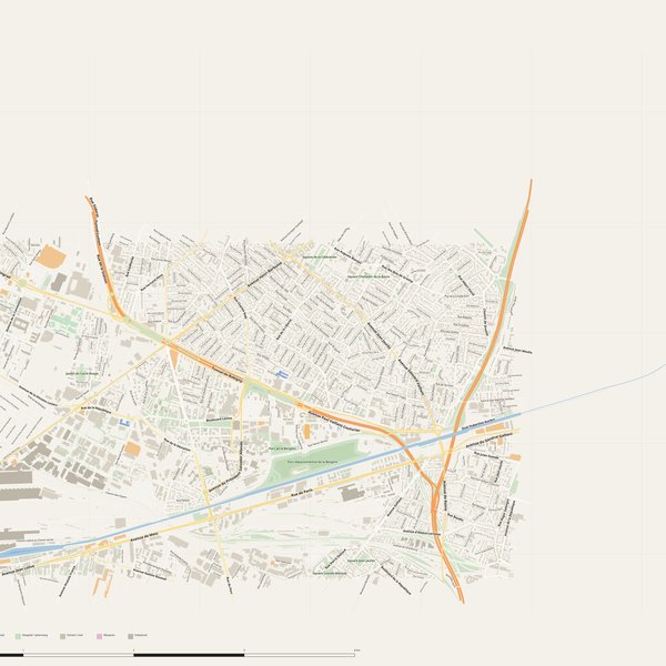
Every street + every house number (centred on building)No POI clutter — addresses speak for themselvesBuilding colour legend in footer (residential / hotel / shop / civic)Vector PDF · scale 1 : 5 000 · paper sized to city extent
The addresses map plus civic landmarks: hospitals, fire stations, police, universities, pharmacies. Built for office walls, dispatch rooms, planning departments.
Every street + every house numberHospitals, fire stations, police, universities, pharmacies markedDistinct shapes per category — readable in black & white photocopyVector PDF · scale 1 : 5 000 · paper sized to city extent
Real numbers from the OpenStreetMap data this map is rendered from.
763named streets
423km of streets
5,222house numbers
16,797buildings
712parks & green areas
Longest streets in Bobigny
Avenue Paul Vaillant-Couturier6.92 km
Rue de Paris6.15 km
Piste cyclable de l'Ourcq4.96 km
Avenue Jean Jaurès4.66 km
Tunnel de Bobigny4.44 km
Avenue Henri Barbusse3.32 km
Civic services on the pro map
SchoolsÉcole maternelle Maximilien Robespierre · Section d'enseignement professionnel du Lycée Lucie Aubrac · Collège privé Charles Péguy +7
PharmaciesPharmacie Ohayon · Pharmacie Centrale · Pharmacie Micoulaud +7
KindergartensCrèche Babilou · Gazouillis · Micro Chouette du Canal +7
PolicePolice municipale · Police nationale · Gendarmerie nationale +1
ClinicsCentre Médical et Dentaire Avenir · Centre Polyvalent de Santé Aimé Césaire
UniversitiesUniversité Sorbonne Paris Nord · Université Sorbonne Paris Nord, Campus de Bobigny
HospitalsHôpital Avicenne · Clinique du Bois d'Amour
Fire stationsCentre de secours de Pantin · Centre de secours de Drancy
The Bobigny map, printed
What you get and how it prints.
What size is the printed Bobigny poster?
At the native scale of 1 : 5 000 the Bobigny map measures about 105 × 60 cm. It is a vector PDF, so you can also print it smaller (A3, A2) or larger without any loss of sharpness.
What exactly is on the map?
763 named streets (423 km in total), 5,222 house numbers placed on their buildings, parks, rivers and civic landmarks — all from current OpenStreetMap data for Bobigny.
What file formats do I get?
A vector PDF (prints sharp from A4 up to a 2-metre wall poster) and a large JPG preview. One file, instant download, no subscription.
Can I get a refund?
14-day refund, no questions asked. See our refund policy. →