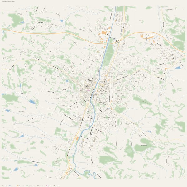
Large-format printable PDF maps of Auch, France — every street with its name, every house number centred on its building, hospitals, schools and civic services. Vector PDF: print sharp at any size, from desk format to a wall poster.
Three printable PDF maps from the same OpenStreetMap data — pick the one for your use case. Single-file download, no subscription, vector quality at any print size.
FREE
Free city map
Every street with its name on a clean overview of the whole city. Good for orientation, route planning meetings, and as a base layer your team can mark up.
All streets, all street namesParks, water, civic landmarksNo house numbers — see the streets-with-numbers map for thoseVector PDF · scale 1 : 5 000 · paper sized to city extent
House numbers placed in the centre of every building, every street labelled. Pure address map — no clutter. For mailroom, courier, planning, surveying.
Every street + every house number (centred on building)No POI clutter — addresses speak for themselvesBuilding colour legend in footer (residential / hotel / shop / civic)Vector PDF · scale 1 : 5 000 · paper sized to city extent
The addresses map plus civic landmarks: hospitals, fire stations, police, universities, pharmacies. Built for office walls, dispatch rooms, planning departments.
Every street + every house numberHospitals, fire stations, police, universities, pharmacies markedDistinct shapes per category — readable in black & white photocopyVector PDF · scale 1 : 5 000 · paper sized to city extent
PolicePolice Nationale · Police Municipale d'Auch · Gendarmerie Nationale
UniversitiesInstitut de Formation des Métiers de la Santé du Gers · Institut de Formation en Soins Infirmiers du Gers · IUT Paul Sabatier +1
KindergartensMaison de la Petite Enfance
HospitalsCentre Hospitalier Spécialisé du Gers · Centre Hospitalier d'Auch · Centre Hospitalier d'Auch - La Ribère
Fire stationsCentre de Secours Principal d'Auch
ClinicsClinique Maladies Mentales d'Embats
The Auch map, printed
What you get and how it prints.
What size is the printed Auch poster?
At the native scale of 1 : 5 000 the Auch map measures about 280 × 216 cm. It is a vector PDF, so you can also print it smaller (A3, A2) or larger without any loss of sharpness.
What exactly is on the map?
830 named streets (854 km in total), 2,306 house numbers placed on their buildings, parks, rivers and civic landmarks — all from current OpenStreetMap data for Auch.
What file formats do I get?
A vector PDF (prints sharp from A4 up to a 2-metre wall poster) and a large JPG preview. One file, instant download, no subscription.
Can I get a refund?
14-day refund, no questions asked. See our refund policy. →