Large-format printable PDF maps of Aubagne, France — every street with its name, every house number centred on its building, hospitals, schools and civic services. Vector PDF: print sharp at any size, from desk format to a wall poster.
Three printable PDF maps from the same OpenStreetMap data — pick the one for your use case. Single-file download, no subscription, vector quality at any print size.
FREE
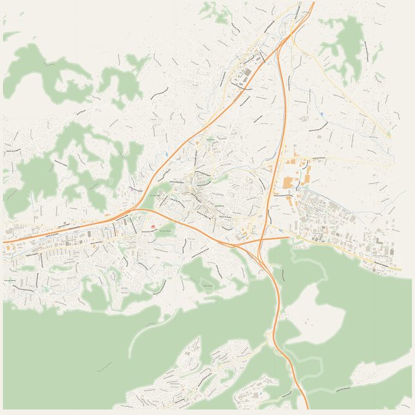
Free city map
Every street with its name on a clean overview of the whole city. Good for orientation, route planning meetings, and as a base layer your team can mark up.
All streets, all street namesParks, water, civic landmarksNo house numbers — see the streets-with-numbers map for thoseVector PDF · scale 1 : 5 000 · paper sized to city extent
House numbers placed in the centre of every building, every street labelled. Pure address map — no clutter. For mailroom, courier, planning, surveying.
Every street + every house number (centred on building)No POI clutter — addresses speak for themselvesBuilding colour legend in footer (residential / hotel / shop / civic)Vector PDF · scale 1 : 5 000 · paper sized to city extent
The addresses map plus civic landmarks: hospitals, fire stations, police, universities, pharmacies. Built for office walls, dispatch rooms, planning departments.
Every street + every house numberHospitals, fire stations, police, universities, pharmacies markedDistinct shapes per category — readable in black & white photocopyVector PDF · scale 1 : 5 000 · paper sized to city extent
Real numbers from the OpenStreetMap data this map is rendered from.
1,165named streets
819km of streets
2,953house numbers
25,025buildings
230parks & green areas
Longest streets in Aubagne
Autoroute Est9.12 km
Route d'Eoures4.46 km
Route de Gémenos4.15 km
Route de la Ciotat3.77 km
Route de la Légion3.21 km
Route de Beaudinard3.2 km
Civic services on the pro map
PolicePolice nationale · Police municipal · Gendarmerie nationale
PharmaciesPharmacie de la République · Pharmacie Beau Soleil · Pharmacie Lyautey +7
SchoolsÉcole maternelle Joliot-Curie · École primaire Paul Éluard · Segpa du Collège Lou Garlaban +7
KindergartensCrèche municipale Le jardin des Arcades · Crèche Petit Jules · Kangourou Kids +2
ClinicsCabinet Médical des Défensions · Clinique des trois Cyprès · Centre médical Saint Estève +1
UniversitiesInstitut de Chimie Oenologie de Paris - Provence · Département SATIS · Instituts de formations paramédicales du Centre Hospitalier Edmond Garcin d'Aubagne
HospitalsCentre hospitalier Valvert · Hôpital de Jour Les Ecoutilles · Centre Hospitalier d'Aubagne +3
Fire stationsCentre de secours principal d'Aubagne · Centre d'incendie et de secours de Carnoux-en-Provence · Centre d'incendie et de secours de Roquefort-la-Bédoule +2
The Aubagne map, printed
What you get and how it prints.
What size is the printed Aubagne poster?
At the native scale of 1 : 5 000 the Aubagne map measures about 176 × 220 cm. It is a vector PDF, so you can also print it smaller (A3, A2) or larger without any loss of sharpness.
What exactly is on the map?
1,165 named streets (818 km in total), 2,953 house numbers placed on their buildings, parks, rivers and civic landmarks — all from current OpenStreetMap data for Aubagne.
What file formats do I get?
A vector PDF (prints sharp from A4 up to a 2-metre wall poster) and a large JPG preview. One file, instant download, no subscription.
Can I get a refund?
14-day refund, no questions asked. See our refund policy. →