Large-format printable PDF maps of Armentières, France — every street with its name, every house number centred on its building, hospitals, schools and civic services. Vector PDF: print sharp at any size, from desk format to a wall poster.
Three printable PDF maps from the same OpenStreetMap data — pick the one for your use case. Single-file download, no subscription, vector quality at any print size.
FREE
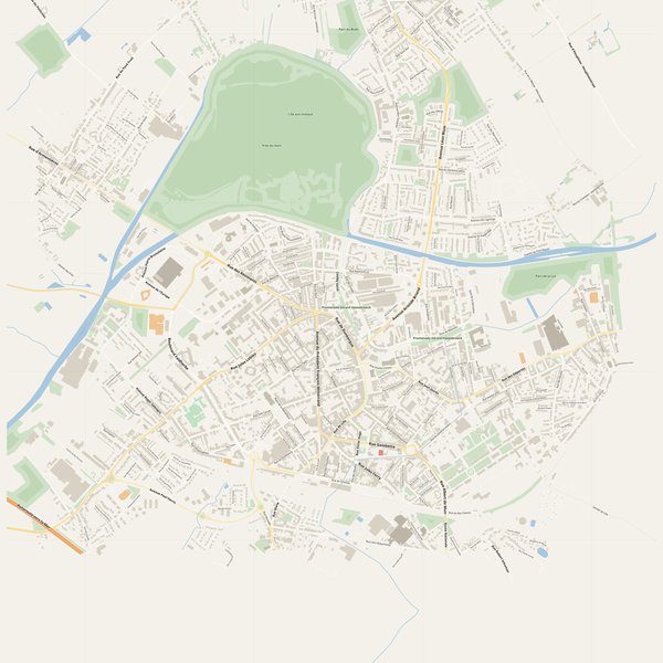
Free city map
Every street with its name on a clean overview of the whole city. Good for orientation, route planning meetings, and as a base layer your team can mark up.
All streets, all street namesParks, water, civic landmarksNo house numbers — see the streets-with-numbers map for thoseVector PDF · scale 1 : 5 000 · paper sized to city extent
House numbers placed in the centre of every building, every street labelled. Pure address map — no clutter. For mailroom, courier, planning, surveying.
Every street + every house number (centred on building)No POI clutter — addresses speak for themselvesBuilding colour legend in footer (residential / hotel / shop / civic)Vector PDF · scale 1 : 5 000 · paper sized to city extent
The addresses map plus civic landmarks: hospitals, fire stations, police, universities, pharmacies. Built for office walls, dispatch rooms, planning departments.
Every street + every house numberHospitals, fire stations, police, universities, pharmacies markedDistinct shapes per category — readable in black & white photocopyVector PDF · scale 1 : 5 000 · paper sized to city extent
Real numbers from the OpenStreetMap data this map is rendered from.
384named streets
182km of streets
1,284house numbers
13,787buildings
251parks & green areas
Longest streets in Armentières
Avenue Léon Blum3.02 km
Boulevard Faidherbe2.59 km
Rue d'Armentières2.47 km
Avenue Léo Lagrange1.66 km
Rue des Résistants1.64 km
Avenue Paul Harris1.58 km
Civic services on the pro map
Fire stationsCaserne d'Armentières
PoliceAntenne de Le Bizet · Police nationale
PharmaciesPharmacie d'Ercan · Pharmacie Bouton · Pharmacie de la Répubique +7
SchoolsÉcole maternelle Suzanne Crapet · École primaire Suzanne Crapet · Lycée général et technologique privé Saint-Jude +7
UniversitiesInstitut de formation en soins infirmiers Flandre intérieure · Institut de formation d'aides-soignants Flandre - EPSM Lille Métropole · Enseignement supérieur Saint-Jude
KindergartensGribouille et Moi · Garderie périscolaire maternelle Mozart
HospitalsSoins de Suite et de Réadaptation - Résidences Curie et Rostand · Établissement Public de Santé Mentale · Centre hospitalier d'Armentières
The Armentières map, printed
What you get and how it prints.
What size is the printed Armentières poster?
At the native scale of 1 : 5 000 the Armentières map measures about 68 × 67 cm. It is a vector PDF, so you can also print it smaller (A3, A2) or larger without any loss of sharpness.
What exactly is on the map?
384 named streets (182 km in total), 1,284 house numbers placed on their buildings, parks, rivers and civic landmarks — all from current OpenStreetMap data for Armentières.
What file formats do I get?
A vector PDF (prints sharp from A4 up to a 2-metre wall poster) and a large JPG preview. One file, instant download, no subscription.
Can I get a refund?
14-day refund, no questions asked. See our refund policy. →