Large-format printable PDF maps of Annemasse, France — every street with its name, every house number centred on its building, hospitals, schools and civic services. Vector PDF: print sharp at any size, from desk format to a wall poster.
Three printable PDF maps from the same OpenStreetMap data — pick the one for your use case. Single-file download, no subscription, vector quality at any print size.
FREE
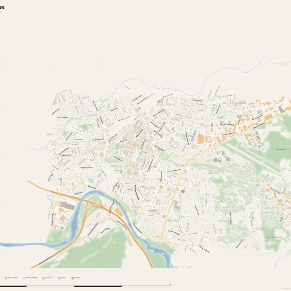
Free city map
Every street with its name on a clean overview of the whole city. Good for orientation, route planning meetings, and as a base layer your team can mark up.
All streets, all street namesParks, water, civic landmarksNo house numbers — see the streets-with-numbers map for thoseVector PDF · scale 1 : 5 000 · paper sized to city extent
House numbers placed in the centre of every building, every street labelled. Pure address map — no clutter. For mailroom, courier, planning, surveying.
Every street + every house number (centred on building)No POI clutter — addresses speak for themselvesBuilding colour legend in footer (residential / hotel / shop / civic)Vector PDF · scale 1 : 5 000 · paper sized to city extent
The addresses map plus civic landmarks: hospitals, fire stations, police, universities, pharmacies. Built for office walls, dispatch rooms, planning departments.
Every street + every house numberHospitals, fire stations, police, universities, pharmacies markedDistinct shapes per category — readable in black & white photocopyVector PDF · scale 1 : 5 000 · paper sized to city extent
Real numbers from the OpenStreetMap data this map is rendered from.
563named streets
430km of streets
4,032house numbers
8,369buildings
2,327parks & green areas
Longest streets in Annemasse
Autoroute Blanche18.55 km
Route de Thonon4.35 km
Rue de l'Industrie3.59 km
Route de Taninges3.19 km
Rue des Voirons3.13 km
Avenue de Verdun2.95 km
Civic services on the pro map
PharmaciesPharmacie Croix Verte · Pharmacie de Livron · Grande pharmacie de Genève +7
KindergartensBébé d'Amour · Crèche Paprika · Mini crèche de Romagny +6
ClinicsCentre Alfred Binet · Le Cabinet (CAB) Infirmier des Erables · Clinique Pierre de Soleil
SchoolsÉcole technique privée Silvya Terrade · École élémentaire de Bois-Livron · École primaire de Cornières +7
PolicePolice municipale · Gendarmerie nationale · Maison de la tranquillité publique +1
UniversitiesPôle métropolitain du Genevois français · MBway Grand Genève · École technique privée Écoris
Fire stationsCentre de secours principal d'Annemasse-Gaillard
HospitalsCentre Joseph Daquin · Maison des Adolescents Vetraz Monthoux · Hôpital privé Pays de Savoie +1
The Annemasse map, printed
What you get and how it prints.
What size is the printed Annemasse poster?
At the native scale of 1 : 5 000 the Annemasse map measures about 103 × 62 cm. It is a vector PDF, so you can also print it smaller (A3, A2) or larger without any loss of sharpness.
What exactly is on the map?
563 named streets (429 km in total), 4,032 house numbers placed on their buildings, parks, rivers and civic landmarks — all from current OpenStreetMap data for Annemasse.
What file formats do I get?
A vector PDF (prints sharp from A4 up to a 2-metre wall poster) and a large JPG preview. One file, instant download, no subscription.
Can I get a refund?
14-day refund, no questions asked. See our refund policy. →