Large-format printable PDF maps of Aix-en-Provence, France — every street with its name, every house number centred on its building, hospitals, schools and civic services. Vector PDF: print sharp at any size, from desk format to a wall poster.
Three printable PDF maps from the same OpenStreetMap data — pick the one for your use case. Single-file download, no subscription, vector quality at any print size.
FREE
Free city map
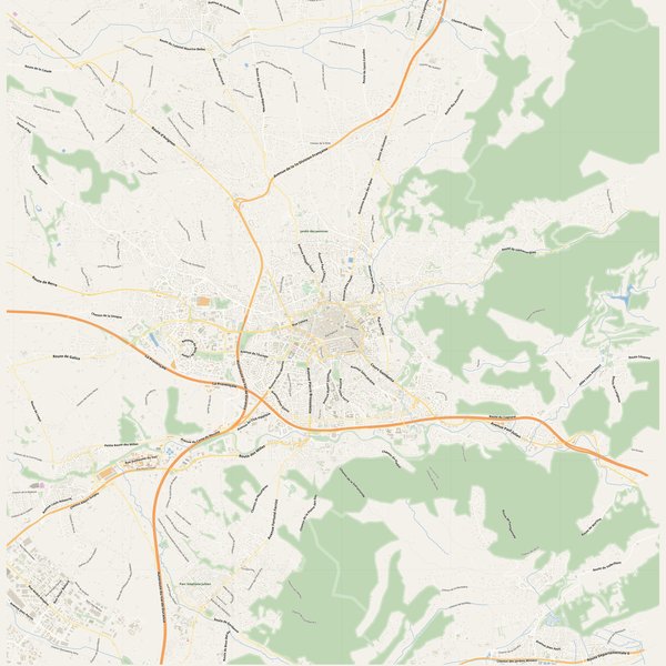
Every street with its name on a clean overview of the whole city. Good for orientation, route planning meetings, and as a base layer your team can mark up.
All streets, all street namesParks, water, civic landmarksNo house numbers — see the streets-with-numbers map for thoseVector PDF · scale 1 : 5 000 · paper sized to city extent
House numbers placed in the centre of every building, every street labelled. Pure address map — no clutter. For mailroom, courier, planning, surveying.
Every street + every house number (centred on building)No POI clutter — addresses speak for themselvesBuilding colour legend in footer (residential / hotel / shop / civic)Vector PDF · scale 1 : 5 000 · paper sized to city extent
The addresses map plus civic landmarks: hospitals, fire stations, police, universities, pharmacies. Built for office walls, dispatch rooms, planning departments.
Every street + every house numberHospitals, fire stations, police, universities, pharmacies markedDistinct shapes per category — readable in black & white photocopyVector PDF · scale 1 : 5 000 · paper sized to city extent
Real numbers from the OpenStreetMap data this map is rendered from.
2,842named streets
2,997km of streets
5,596house numbers
70,479buildings
1,254parks & green areas
Longest streets in Aix-en-Provence
La Provençale48.76 km
Autoroute du Val de Durance41.98 km
Route de Berre19.03 km
Route d'Apt16.08 km
Route de Saint-Canadet10.87 km
Route de Roquefavour10.55 km
Civic services on the pro map
PharmaciesPharmacie Centre Commercial du Deffens · Pharmacie de l'Espace Forbin · Pharmacie Méjanes +7
SchoolsÉcole maternelle de Cuques · École maternelle Jules Ferry · École maternelle de la Salle +7
UniversitiesCVRH · École Nationale des Techniciens de l'Équipement · ADREP Formation +7
KindergartensCrèche L'île aux enfants · L'atelier · Baby Sympony +7
PolicePolice Municipale · Gendarmerie nationale · Police municipale +1
ClinicsAixel vision - centre d'ophtalmologie · Centre d'imagerie médicale Rambot · Bastide d'Axium +7
HospitalsHôpital de jour Acanthe · Centre hospitalier Montperrin · Centre hospitalier du Pays d'Aix +4
Fire stationsCentre d'incendie et de secours de Gardanne · Centre de secours principal d'Aix-en-Provence - La Chevalière · Centre d'incendie et de secours de Luynes +1
The Aix-en-Provence map, printed
What you get and how it prints.
What size is the printed Aix-en-Provence poster?
At the native scale of 1 : 5 000 the Aix-en-Provence map measures about 413 × 429 cm. It is a vector PDF, so you can also print it smaller (A3, A2) or larger without any loss of sharpness.
What exactly is on the map?
2,842 named streets (2,997 km in total), 5,596 house numbers placed on their buildings, parks, rivers and civic landmarks — all from current OpenStreetMap data for Aix-en-Provence.
What file formats do I get?
A vector PDF (prints sharp from A4 up to a 2-metre wall poster) and a large JPG preview. One file, instant download, no subscription.
Can I get a refund?
14-day refund, no questions asked. See our refund policy. →